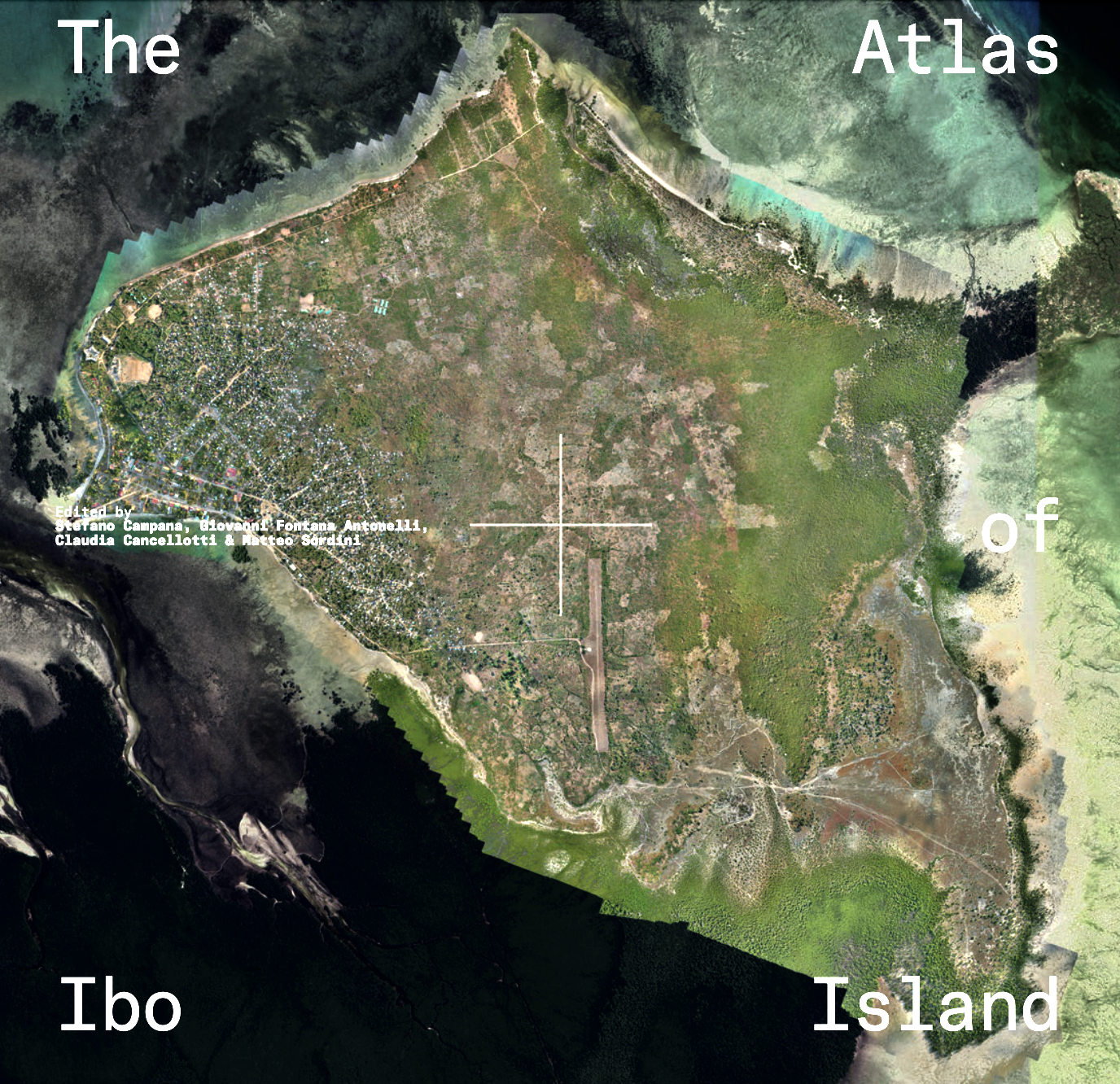
The Atlas of Ibo Island

Ibo Island is part of the Quirimbas Archipelago in northern Mozambique, known for its Swahili-Portuguese heritage, historical buildings, and ecological richness. The Atlas of Ibo Island is the result of a project focused on protecting the island’s cultural and natural heritage, which is threatened by climate change and displacement caused by armed conflict in the region. The Atlas documents this endangered heritage through drone surveys and GIS-based mapping, providing an evidence-based foundation for future conservation planning. The work was carried out using conflict-sensitive methodologies and local engagement with Fundação IBO and Associação do Sistema de Monitoria Orientada para a Gestão (ASMOG). The result is not only a visual and technical record, but also a reflection of the continued presence of Swahili-Portuguese architecture and its living heritage, the role of local communities, and the ongoing challenges faced by heritage professionals. As the first publication of the Archi.Media Trust, The Atlas of Ibo Island is a key outcome of a project funded by ALIPH and implemented by Archi.Media Trust.
Published by
Archi.Media Trust
Edited by
S. Campana, G. Fontana Antonelli, C. Cancellotti and M. Sordini
Link to project
Rescuing Ibo Island’s historic architectural heritage from the impact of jihadist terrorism in Northern Mozambique
Access to the book
The Atlas will be published in June 2025 and be available for free on the project website.